Choosing an industrial drone in 2026 starts with the work, not the marketing claims. A mine survey, a solar-panel inspection, and a warehouse inventory check require different aircraft, sensors, and workflows. How to Choose an Industrial Drone is therefore a practical question about matching equipment to real operating conditions. A thermal camera may reveal a failing panel, while a high-resolution zoom lens can help inspect a distant structure. The right choice depends on what the team must measure and how often.
Look closely at flight time under working conditions, not just the maximum listed on the product page. A loaded drone facing wind may stay airborne for less time than expected. Check payload limits, weather resistance, obstacle sensing, positioning accuracy, and battery availability. Small details matter. Can the aircraft carry the required sensor and still complete a safe route? Can staff review, store, and share the collected data without adding avoidable steps? These questions can reveal costs that a purchase price alone hides.
This guide will compare key drone types, essential specifications, software, support, and ownership costs. It will also explain how to assess training needs and verify that planned operations follow applicable local requirements. Ask vendors for demonstrations using representative tasks, and review service terms before committing. No single model is perfect. A specification sheet can look convincing, yet field performance may differ; that deserves honest scrutiny. The goal is not to buy the most advanced aircraft, but to choose a dependable system that fits the job, the people using it, and the conditions where it will fly.
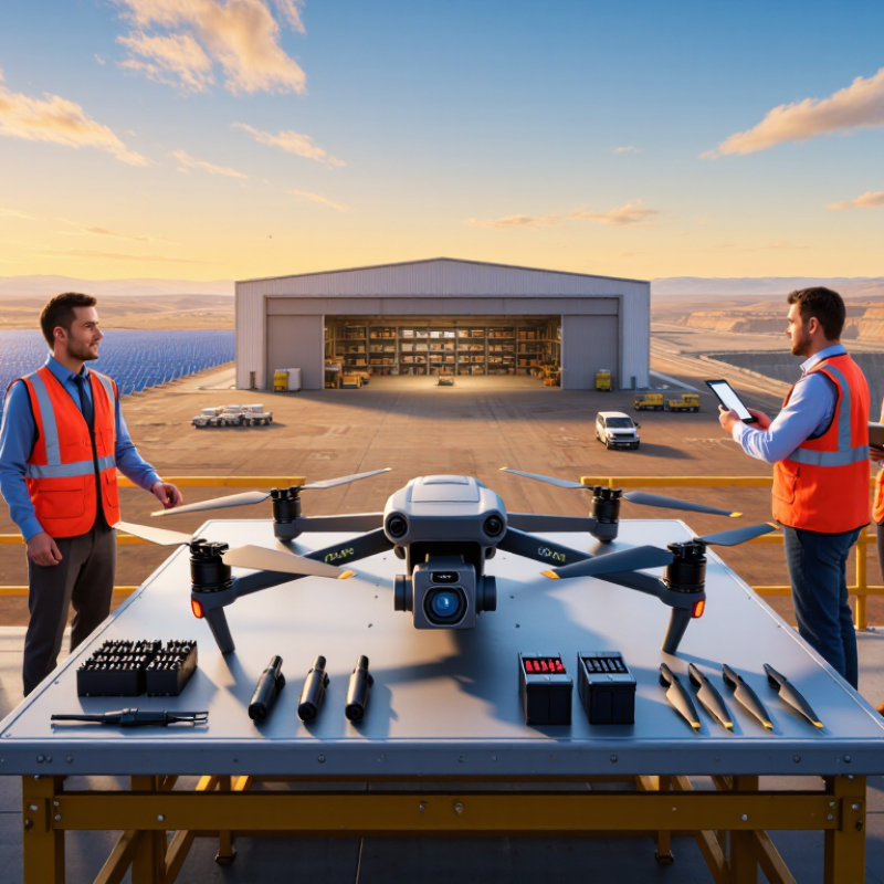
Define the Industrial Task and Operating Environment
Define the job before comparing aircraft. A concrete inspection target, such as a corroded tank seam or a cracked turbine blade, determines the camera, flight path, and image detail required. PwC’s 2016 Clarity from Above report estimated infrastructure drone applications could represent $45.2 billion in annual value worldwide. That figure describes potential market value, not guaranteed savings for an individual site. Treat it as context, not a purchasing promise.
Then walk the operating area. Note indoor or outdoor use, flight distance, wind exposure, dust, heat, poor lighting, and obstacles such as wires or steel beams. Indoor structures can disrupt satellite positioning; test navigation and data capture in the actual space. Be specific about the deliverable: a thermal anomaly map, repeatable measurements, or clear photographs linked to locations. Small details matter. A drone that reaches the asset but produces inconsistent images may create more review work than it removes. The awkward part is that site conditions can change by shift or season, so a tidy test-day result is not enough. Recheck the mission under realistic conditions.
How to Choose the Best Industrial Drone in 2026?
Define the Industrial Task and Operating Environment
Photogrammetry overlap percentages are practical planning starting points, not universal requirements. Complex structures and repetitive surfaces often benefit from higher overlap; adjust for terrain, camera, flight height, and processing workflow.
Compare Drone Types and Airframe Configurations
Industrial work begins with the flight pattern, not the brochure. A multirotor can hold position beside a tower or inspect a narrow roof section. It is easy to launch and land in confined areas, but its hover time can limit coverage on large sites. For close-range inspection, that trade-off may be worthwhile.
Fixed-wing aircraft cover long corridors and broad farmland efficiently. They need space to launch and recover, and they cannot hover over a small defect. A vertical-takeoff-and-landing hybrid combines hovering with forward flight. That flexibility sounds ideal, but extra systems can add weight and maintenance demands. Test the transition between flight modes with the actual sensor load.
Airframe configuration matters as much as aircraft type. A multirotor with six arms may offer added motor redundancy, while a compact four-arm frame can be easier to transport and service. Check payload capacity, mounting points, and balance with the camera or sensor installed. A heavy sensor placed too far forward can affect stability. Small detail, big consequence. Match materials and protection to the worksite: dust, rain, vibration, and repeated handling all matter. Compare flight time under working conditions, not just unloaded test figures. Real sites are rarely neat. A short field trial can reveal awkward battery changes or blocked sensor views that a specification sheet misses.
Evaluate Payload, Flight Performance, and System Compatibility
Payload, flight performance, and system compatibility matter more than a headline specification. Check the drone’s usable payload after accounting for its camera, mount, cables, and battery. A two-kilogram rating may leave little room for a heavier thermal sensor. Not just the sensor. Ask for payload limits across realistic temperatures, and test the aircraft with the exact equipment you plan to carry.
Flight time should be measured with that payload attached. Wind, cold weather, hovering, and repeated takeoffs can all reduce endurance. A long advertised range does not guarantee a useful work window. For example, map a typical inspection route, then include time for setup, return, and a safe landing reserve. Record actual results over several flights; one calm-day test can be misleading.
Compatibility is easy to overlook. Confirm that the aircraft can export data in formats your mapping or asset-management tools accept. Check control interfaces, battery availability, charging time, and how quickly a technician can replace a damaged propeller. Run a small integration test before committing to a full fleet. I would not assume that a familiar file format means a smooth workflow; metadata and coordinate settings can still cause delays. A short field trial often reveals more than a polished specification sheet.
Check Safety Features, Regulations, and Data Security
When choosing an industrial drone in 2026, look past camera resolution and payload capacity. Safety features matter most when a machine works near roofs, cranes, or crews. Check for obstacle detection, clear low-battery warnings, and a reliable return-to-home function. Test how the drone behaves when its signal weakens. A feature listed on a specification sheet is not proof it works well in wind or dust.
Check current aviation rules in every area where the drone will operate. Requirements can vary by location, flight purpose, and aircraft weight. Confirm airspace limits, operator qualifications, site permissions, and record-keeping duties with the relevant authority. Keep a written preflight checklist, and make sure workers know who can pause a flight. Small details matter.
Data security deserves the same attention as flight safety. Ask whether control links and stored files are encrypted, who can access them, and how long they remain on the system. Review update procedures, account controls, and audit logs. If imagery includes a factory floor or customer site, define where it is stored and who may share it. No checklist catches every failure. Field conditions can expose gaps that a careful test missed, so review incidents honestly and adjust procedures.
Compare Total Ownership Costs and Manufacturer Support
An industrial drone’s purchase price is only the opening line in its cost sheet. Compare batteries, payload mounts, charging equipment, software subscriptions, training, and planned maintenance over three to five years. A lower upfront price can fade quickly when a team needs extra batteries or specialist repairs. Downtime costs too.
Ask manufacturers for written warranty terms, typical repair turnaround, and the price and availability of common replacement parts. Clarify what support includes: onboarding, operator refreshers, software assistance, and troubleshooting in the field. A fast reply matters, but access to a stocked service center may matter more when a damaged component grounds the aircraft. Request references from users with similar weather, workloads, and flight frequency. Vague promises are hard to budget.
Build an annual estimate using expected flight hours, battery replacement intervals, storage needs, and staff time for inspections. Compare that estimate with the support plan, not just the sales quote. The numbers will still be imperfect; actual repair frequency is difficult to predict. Document that uncertainty. If a supplier cannot explain service steps or likely costs plainly, treat the gap as a cost risk, not a minor detail.
How to Choose the Best Industrial Drone in 2026? — Compare Total Ownership Costs and Manufacturer Support
| Drone configuration |
Typical industrial use |
Representative flight time |
Aircraft, controller & payload |
Batteries & spares |
Software, 3 years |
Training |
Maintenance & repair reserve |
Support plan, 3 years |
Estimated 3-year TCO |
| Compact multirotor inspection system |
Close-range visual inspections of buildings, roofs, and small assets |
25–40 minutes, depending on payload and conditions |
$12,000 |
$3,000 |
$4,500 |
$1,500 |
$3,000 |
$3,000; remote technical assistance and standard parts support |
$27,000 |
| Thermal multirotor inspection system |
Thermal surveys of energy assets, industrial equipment, and building envelopes |
25–40 minutes, depending on thermal payload and conditions |
$28,000 |
$6,000 |
$7,500 |
$2,500 |
$7,000 |
$6,000; remote assistance, repair coordination, and priority parts access |
$57,000 |
| Heavy-lift multirotor system |
Carrying specialist sensors or equipment for demanding, short-duration missions |
20–35 minutes, depending on payload and conditions |
$55,000 |
$12,000 |
$9,000 |
$4,000 |
$18,000 |
$12,000; priority technical assistance and scheduled maintenance coordination |
$110,000 |
| Fixed-wing mapping system |
Large-area surveying and mapping where runway-style launch and recovery are practical |
60–90 minutes, depending on configuration and conditions |
$22,000 |
$5,000 |
$9,000 |
$2,000 |
$6,000 |
$5,000; remote technical assistance and standard repair support |
$49,000 |
| VTOL fixed-wing mapping system |
Large-area mapping at sites without a suitable runway or launch strip |
45–75 minutes, depending on configuration and conditions |
$38,000 |
$8,000 |
$9,000 |
$3,000 |
$10,000 |
$8,000; priority remote assistance and repair coordination |
$76,000 |
|
Planning estimates in USD for 2026, not supplier quotations. Three-year TCO is the sum of the listed aircraft and payload, batteries and spares, software, training, maintenance and repair reserve, and support plan. Actual costs vary by payload, region, usage, service terms, and regulatory requirements. Flight times are representative ranges, not guarantees. Estimates exclude operator labor, insurance, taxes, travel, and financing. Before purchasing, confirm repair turnaround, parts availability, software licensing, training scope, and support response terms directly with the manufacturer or authorized service provider.
|
Conclusion
How to Choose an Industrial Drone in 2026 starts with a clear understanding of the work it must perform and the conditions in which it will operate. Inspection, mapping, monitoring, and logistics tasks can call for different aircraft, so compare multirotor, fixed-wing, and hybrid configurations based on coverage, maneuverability, launch space, and landing requirements. Then assess payload capacity, camera or sensor options, flight time, range, weather tolerance, and compatibility with the software and equipment already used by your team.
A reliable choice also depends on safe operation, appropriate regulatory compliance, and strong protection for collected data. Look beyond the purchase price: include training, maintenance, batteries, software, repairs, and expected service life when estimating total ownership costs. Finally, consider the manufacturer’s documentation, warranty, spare-parts availability, and technical support. Matching these factors to your operational priorities helps you select a capable system that is practical to deploy, maintain, and use over time.

 UUUFLY