Choosing an industrial drone is not simply a matter of comparing camera resolution or flight time. A reliable Industrial Drone Buying Guide must connect aircraft performance with real workplace demands. A mining survey may require a rugged airframe, thermal imaging, obstacle avoidance, and stable positioning near metal structures. A warehouse inspection may prioritize quiet operation, indoor navigation, and battery replacement speed. These differences shape the purchasing decision.
This guide is written for global buyers who need practical, evidence-based direction. It examines payload capacity, operating range, weather resistance, data security, maintenance access, training, and after-sales support. It also considers local aviation rules, import requirements, privacy obligations, and approved operating zones. Compliance should be checked before a purchase order is signed. A technically excellent drone can still become an expensive asset if operators cannot use it legally or safely.
Real-world testing matters. Request flight demonstrations, inspection samples, battery-cycle data, and service response times. Ask how the supplier handles firmware updates and damaged components. Small details matter. A loose charging connector can delay an entire workday. Total cost includes software licenses, spare batteries, pilot training, insurance, and scheduled maintenance. Some claims may look impressive but lack independent verification. Treat them carefully.
No guide removes every uncertainty. Site conditions change, and early estimates can be wrong. A limited pilot project may reveal weak signals, confusing software, or unrealistic endurance. That is useful evidence, not failure. With disciplined evaluation, documented requirements, and transparent supplier communication, global buyers can select an industrial drone that delivers measurable value without sacrificing safety, reliability, or regulatory responsibility.
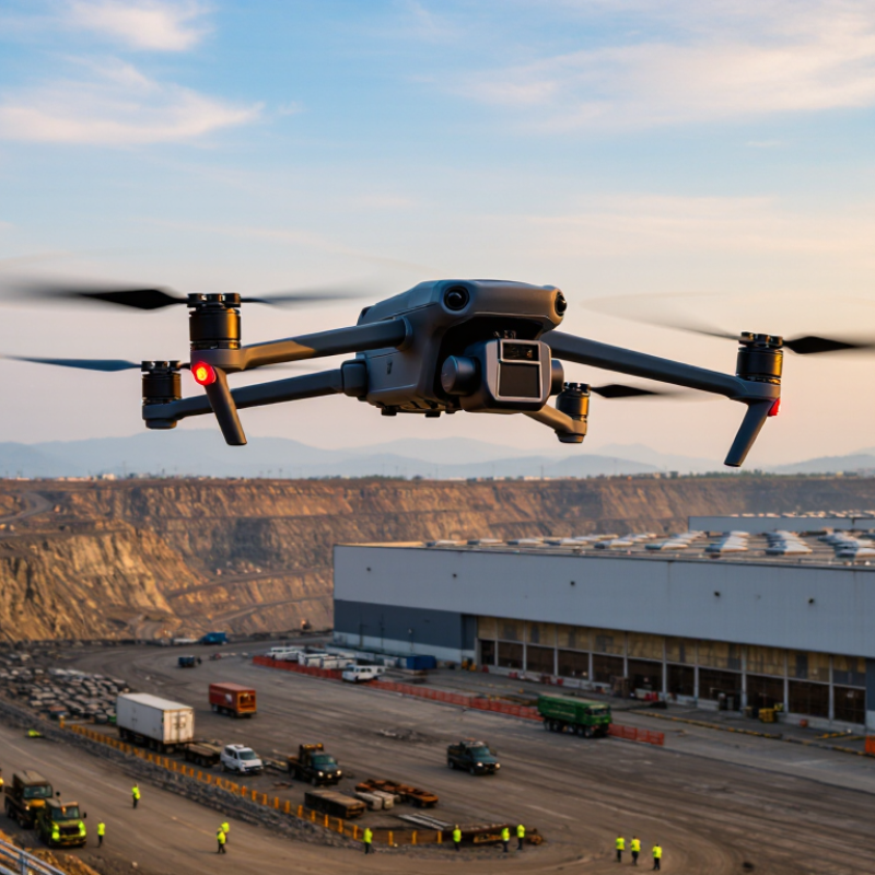
Industrial drones are unmanned aircraft designed for demanding commercial and public-sector work. Unlike consumer models, they often carry thermal cameras, LiDAR, multispectral sensors, or high-resolution imaging systems. Their value comes from repeatable data collection, not simple flight.
In global operations, these aircraft inspect power lines, storage tanks, bridges, wind turbines, mines, farms, and construction sites. A drone can follow a planned route, capture images every few meters, and flag a damaged bolt or overheated component. This reduces climbing, road access, and exposure to unstable ground. It also supports progress records across different countries, where teams need consistent evidence and clear timestamps.
A practical buying guide should connect the aircraft to the worksite. Buyers should assess payload weight, flight endurance, weather resistance, navigation reliability, data security, operator training, and local airspace requirements. A powerful camera is not enough. Dust, salt air, weak connectivity, or poor lighting can undermine a good survey. Field teams sometimes focus heavily on advertised flight time, then lose efficiency during wind, battery changes, and data processing. That assumption deserves review. The best industrial drone is not always the largest or most advanced. It is the system that produces reliable, usable information under real operating conditions. Safety must remain part of the purchase decision.
Industrial drone buying starts with the worksite, not the aircraft’s advertised range.
Multirotor drones hover over bridges, towers, stockpiles, and construction zones. Their vertical takeoff suits confined areas, although batteries may limit long inspections. Fixed-wing drones cover large farms, pipelines, and coastal sites efficiently. They need launch space and cannot remain stationary. VTOL models combine both advantages, but their control systems can be more demanding.
Tethered drones provide continuous power for site monitoring, emergency communications, or persistent observation. Thermal cameras help detect overheated equipment, insulation gaps, and nighttime hazards. High-resolution optical cameras support roof surveys and construction records. LiDAR payloads can map terrain beneath vegetation, but skilled processing remains essential. In practice, poor flight planning can waste an expensive sensor. That is an easy mistake. Global buyers should compare payload capacity, wind resistance, battery logistics, repair access, and data protection. Local aviation rules and site permissions also matter before deployment.
Tips: Define one measurable task, such as mapping 20 hectares daily. Request sample data from a similar environment. Test the drone in wind, dust, and weak network conditions. Check operator training and maintenance support. Do not assume the longest flight time is always best. A dependable workflow may matter more than impressive specifications.
Industrial Drone Buying Guide for Global Buyers
Before purchasing, define the job site, not the aircraft. MarketsandMarkets projects the commercial drone market to grow from USD 20.8 billion in 2023 to USD 54.6 billion by 2030. That growth makes specification discipline essential. Compare payload capacity with real equipment installed, including cameras, lights, and protective cages. A drone rated for two kilograms may fly poorly near its limit.
Flight endurance needs field testing. Battery claims often assume calm weather and no payload. Check measured flight time, battery cycle life, charging speed, and replacement cost. Wind resistance also matters around towers, bridges, and coastal facilities. For mapping, compare RTK positioning accuracy, camera resolution, shutter type, and supported data formats. For inspection, thermal sensitivity and optical zoom may matter more than headline megapixels.
Data protection deserves equal attention. Verify encrypted links, local storage options, access controls, and software update procedures. The European Union Aviation Safety Agency’s 2024 annual safety review recorded over 500 drone occurrences, including incidents involving loss of control and technical failures. Redundant positioning, return-to-home behavior, obstacle sensing, and manual override should therefore be tested, not merely listed.
Consider environmental ratings carefully. An IP rating helps against dust and water, but it does not prove reliability in freezing rain. Ask for test conditions and maintenance records. This is where buyers often underestimate cost. A lower-priced aircraft may require more batteries, specialist training, or frequent repairs. Procurement teams should score total operating cost over three years, then challenge their assumptions. The first spreadsheet is rarely perfect.
| Specification | Compact Inspection Platform | Professional Survey and Inspection Platform | Heavy-Lift or Multirotor Work Platform |
|---|---|---|---|
| Typical Use Cases |
Portable Operations Indoor inspection, facility maintenance, construction progress, basic visual documentation |
Professional Data Capture Surveying, mapping, infrastructure inspection, public safety, and industrial asset review |
Payload-Centric Operations Spraying, cargo delivery, lifting, specialized sensing, and long-duration industrial missions |
| Maximum Takeoff Mass | Typically below 4 kg | Approximately 4–25 kg | Approximately 25–100 kg, depending on configuration and local aviation rules |
| Useful Payload Capacity | 0.2–1.0 kg | 1.0–5.0 kg | 5–30 kg or more |
| Typical Flight Time | 25–45 minutes with a standard inspection payload | 30–55 minutes with a camera or mapping payload | 10–35 minutes, depending heavily on payload weight and battery configuration |
| Operational Range | Up to 3–8 km radio link under favorable conditions | Up to 5–15 km radio link under favorable conditions | Up to 5–20 km radio link, subject to airspace, network, and line-of-sight requirements |
| Recommended Wind Resistance | Approximately 8–12 m/s | Approximately 10–15 m/s | Approximately 10–14 m/s; high payloads can reduce handling stability |
| Weather Protection | Look for at least IP43–IP45 for light dust and splash exposure | IP45–IP54 is commonly suitable for planned outdoor inspection work | IP54–IP56 is preferable for demanding outdoor environments; verify payload protection separately |
| Navigation and Positioning | GNSS positioning, optical flow, obstacle sensing, and return-to-home functions | Multi-constellation GNSS, obstacle avoidance, terrain following, and optional RTK positioning | Redundant GNSS, high-precision positioning, terrain awareness, obstacle detection, and failsafe control systems |
| Positioning Accuracy | Approximately 1–3 m with standard satellite positioning | Centimeter-level relative accuracy is achievable with RTK and suitable correction data | Centimeter-level relative accuracy may be achievable with RTK; heavy payloads require careful calibration |
| Camera and Sensor Options | 4K RGB camera, basic digital zoom, LED lighting, or compact thermal camera | High-resolution RGB, optical zoom, radiometric thermal, multispectral, LiDAR, or mapping camera | Interchangeable stabilized gimbals, thermal systems, LiDAR, multispectral sensors, release mechanisms, or spraying equipment |
| Mapping Performance | Suitable for small-area visual records and basic 2D models | Suitable for orthomosaics, 3D models, stockpile measurements, and corridor mapping | Suitable for large-area missions when flight endurance, payload integration, and ground-control procedures are properly managed |
| Battery System | Smart lithium-ion or lithium-polymer battery; typical capacity 60–200 Wh | Smart high-voltage battery; typical capacity 150–600 Wh | High-capacity modular battery packs; commonly 500–3,000 Wh or more |
| Charging and Deployment | Portable charger; approximately 1–2 hours for a complete charge, depending on battery size | Fast charger or multi-battery station; approximately 1–3 hours depending on the power system | High-power charging infrastructure, generator, or vehicle-based charging may be required |
| Operating Temperature | Commonly about −10°C to 40°C | Commonly about −20°C to 50°C, depending on battery and payload specifications | Commonly about −20°C to 45°C; cold-weather battery management is essential |
| Control and Data Link | Encrypted radio link with live video and basic telemetry | Encrypted radio link with HD video, telemetry, RTK correction support, and optional cellular connectivity | Redundant command links, encrypted communications, high-bandwidth video, and optional private cellular or satellite backhaul |
| Safety and Redundancy | Return-to-home, low-battery landing, geofencing, and obstacle sensing | Dual sensors, obstacle avoidance, redundant positioning inputs, route planning, and configurable failsafe actions | Redundant motors or flight systems, emergency landing logic, independent payload control, and documented risk controls |
| Regulatory Considerations | Check registration, pilot competency, remote identification, and visual-line-of-sight requirements | Check aircraft category, operational authorization, pilot licensing, insurance, data protection, and airspace restrictions | Expect additional requirements for higher mass, beyond-visual-line-of-sight flights, cargo, spraying, or operations near people |
| Recommended Purchase Documents | Technical datasheet, battery test report, user manual, charger specifications, and warranty terms | Calibration certificates, RTK compatibility details, payload interface documentation, maintenance schedule, and software terms | Structural load data, motor and propeller specifications, emergency procedures, maintenance records, payload certification, and training documentation |
| Best Buying Priority | Low weight, rapid deployment, image quality, obstacle avoidance, and battery availability | Sensor integration, positioning accuracy, weather resistance, data workflow, serviceability, and regulatory fit | Payload-to-endurance ratio, redundancy, power supply, structural safety, logistics, operator training, and total cost of ownership |
Note: Values are typical industry planning ranges rather than guaranteed performance figures. Actual results vary with payload, altitude, temperature, wind, battery condition, flight profile, radio environment, and applicable national aviation regulations. Always verify the manufacturer’s current technical documentation and local operating requirements before purchase.
Industrial drone purchasing starts with the operating region, not the camera or battery. In the United States, the FAA’s 2024 UAS by the Numbers reported more than one million registered drones. Commercial buyers generally need Part 107 compliance, remote identification, pilot certification, and operational records. Flights usually remain below 400 feet and within visual line of sight.
Rules change. In the European Union, EASA’s regulatory framework places many routine missions in the Open category, with a 120-meter altitude limit. Higher-risk inspections may require an operational authorization under the Specific category. Buyers should confirm class markings, remote identification, geographic-zone restrictions, and data-protection controls before ordering equipment.
Canada, Australia, and Asian markets apply different registration, pilot, and airspace requirements. Transport Canada separates basic and advanced operations, while Australia commonly limits standard operations to 120 meters. ICAO safety reports also emphasize competent operators, maintenance systems, and documented risk management. A supplier’s compliance statement is useful, but insufficient. Request firmware records, encrypted data paths, battery test results, maintenance intervals, and training evidence. Paperwork matters. I would still test the aircraft in the actual worksite, because maps, weather, radio interference, and local permissions can expose weaknesses that a polished specification sheet hides.
For global buyers, an industrial drone purchase begins with the worksite, not the product catalogue. Define payload, flight time, weather exposure, data output, and operating distance. A coastal inspection team may need corrosion-resistant materials, while a quarry crew may value obstacle sensing and dust protection. Ask suppliers for test records, repair procedures, training scope, and spare-part availability. Do not accept only polished demonstrations. Request a flight trial using conditions close to your site. Evidence matters. It reveals weak links quickly.
Supplier evaluation should combine technical evidence with operational experience. Check production consistency, quality controls, software update practices, and response times for support. Ask who performs repairs and where critical parts are stocked. References from similar industries are useful, but verify them independently. A low purchase price can hide expensive batteries, chargers, insurance, data storage, and technician hours. Build a five-year total-cost model. Include shipping, import duties, inspections, scheduled maintenance, battery replacement, and downtime. Costs accumulate. Small omissions become large invoices.
Purchase planning needs a realistic deployment calendar. Allow time for site surveys, operator training, internal approval, and local registration requirements. Confirm delivery milestones in writing, including acceptance tests and documentation. Keep a contingency budget for damaged equipment and delayed parts. Be careful with promised flight time; payload, wind, temperature, and battery age reduce it. Our own estimates are often optimistic. Recheck them after a field trial, then revise the purchasing plan before signing.
This three-year planning benchmark illustrates the main cost dimensions for a medium industrial drone program. Hardware is only one part of the budget; batteries, software, training, maintenance, logistics, insurance, and regulatory compliance should also be included when comparing suppliers. Actual costs vary by payload, flight environment, local regulations, service scope, and purchase volume.
It collects repeatable data for demanding commercial and public-sector work. Typical tasks include inspecting bridges, power lines, tanks, farms, and construction sites. It can record images every few meters. The goal is usable information, not simple flight.
Payloads may include thermal cameras, LiDAR, multispectral sensors, lights, or protective cages. Check the complete installed weight. A drone rated for two kilograms may perform poorly near its limit. More camera power is not always better.
Test flight time with the real payload and expected wind. Battery claims often assume calm weather. Check battery cycles, charging speed, and replacement costs. Battery changes can quietly reduce daily productivity.
Dust, salt air, weak connectivity, and poor lighting can damage survey quality. Wind resistance matters near towers, bridges, and coastal facilities. An IP rating helps with dust and water. It does not guarantee reliability in freezing rain.
Look for reliable positioning, obstacle sensing, and return-to-home behavior. Manual override is also important. Test these functions instead of trusting a specification sheet. Real sites reveal weaknesses.
Thermal imaging can identify overheated components. High-resolution cameras can reveal damaged bolts or surface defects. Planned routes create consistent records across different countries. Clear timestamps make progress easier to verify.
Check encrypted communication links, local storage, and access controls. Review software update procedures and supported data formats. Limit unnecessary access to inspection files. Security details are easy to overlook.
Requirements differ by country and operating category. Check registration, pilot certification, remote identification, altitude limits, and airspace zones. Some missions may need special authorization. A supplier statement is not enough.
Include batteries, charging equipment, repairs, training, maintenance, and data processing. Score costs over three years. A cheaper aircraft may need more specialist support. The first spreadsheet is rarely perfect.
An Industrial Drone Buying Guide helps global buyers understand how unmanned aircraft can support inspection, surveying, mapping, asset monitoring, agriculture, construction, logistics, and emergency planning. It explains the role of industrial drones in improving operational visibility, reducing manual exposure to hazards, collecting accurate data, and increasing efficiency. The guide also compares common drone categories, including multirotor, fixed-wing, hybrid, and specialized platforms, while linking each type to suitable working environments and applications.
Before purchasing, buyers should evaluate flight endurance, payload capacity, camera and sensor options, positioning accuracy, weather resistance, data security, control range, software compatibility, and maintenance requirements. Regional aviation rules, pilot qualifications, airspace restrictions, privacy obligations, insurance, and workplace safety standards must also be reviewed. Finally, the guide recommends assessing suppliers through technical support, training, spare parts, delivery capability, documentation, warranty coverage, and total cost of ownership. A structured purchase plan can help organizations select a compliant, reliable, and cost-effective solution for long-term operations.

UUUFLY